

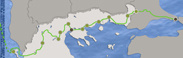
> List of the cultural trail stations Constantinople - Rome: "Constantine the Great"
Constantinople
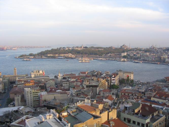 Constantinople, the capital city of the Byzantine Empire, occupied the triangular peninsula formed by the Golden Horn, the Bosphorus and the Sea of Marmara. The city was founded on the site of a Megaran colony named after its founder, Byzas. Constantine the Great recognized the strategic importance of the area, which dominated the Bosphorus and controlled trading routes between the Aegean and the Black Sea. The city was protected by the sea on three sides, while the strong Bosphorus currents made approach particularly difficult. Between 324 and 326 Constantine celebrated all the pagan rituals necessary for founding and establishing the new capital. The official inauguration was held on May 11, 330, along with celebrations for the 25th anniversary of his ascension to the throne; from then on the anniversary of the city’s inauguration was always formally celebrated. More
Pythion
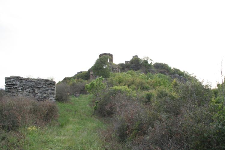
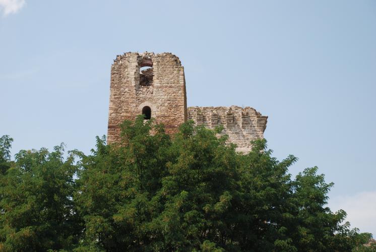 Pythion Castle is built on a low hill at the western limits of the Evros River riparian zone, at a distance of 15 km from both Didymoteicho and Adrianople. Founded between 1330 and 1340 by John VI Catacuzenus, it served as a military fortress and personal refuge during the civil wars of the 14th century. After the castle fell to the Ottomans, a new settlement called Kaleli Burgas grew up around it. The village is the burial place of Patriarch Cyril VI, who was hanged during the revolution. More
Didimotiho
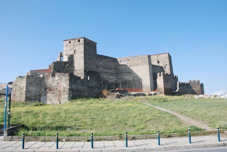
 The Byzantine castle of Didimotiho crowns a rocky hill above the mouth of Erythropotamos River in the Evros region. Founded a short distance from Constantinople, the castle occupied a strategic location as a staging post on the Adrianople to Trajanopolis road. The city was established in Roman times and was repeatedly modified over the course of its long history, particularly from Justinian to Palaeologan times. It became particularly important from the 7th century on, playing a pivotal role in historical developments, but did not reach its peak until the 14th century, when members of the imperial court resided in the castle for lengthy periods. It was a favourite residence of Emperor Andronicus III Palaeologus, partly on account of the exceptional hunting to be had in the region. Furthermore, it was the place where John VI Cantacuzenus was crowned emperor in 1342. More
Anastasioupolis
 Anastasioupoli is located near the top of Lake Vistonida, on the fertile plain at the foot of the Rhodope Mountains. From Roman times it was a staging post on the Via Egnatia known as Stabulo Diomedis (=Diomedes’ Stables); tradition held it to be the pastures of the wild and bloodthirsty horses of Diomedes, which only Hercules managed to capture. The name Anastasioupoli is first attested by the historian Procopius , and is probably derived from Emperor Anastasius I (491-518), who fortified it for the first time. After being destroyed by Ivan Asan in 1206, and re-founded in 1341 by Andronicus III Palaeologus, the city was named Peritheorio. More
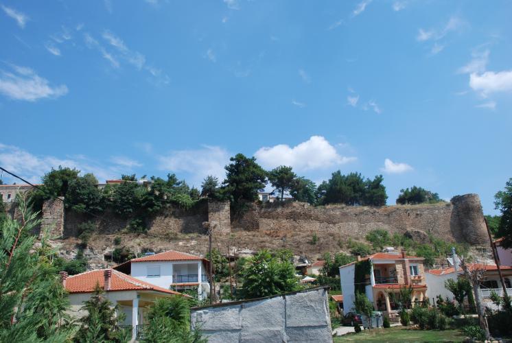
Kavala
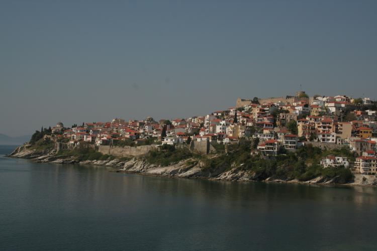 The city of Kavala rises amphitheatrically up the side of a peninsula named after the Blessed Virgin Mary, south of Mount Symvolo. This shows signs of continuous habitation from antiquity to the present day, lying as it does at a strategic position between Thrace and Macedonia. In the 7th century BC it was apparently chosen by settlers from the islands of Thasos and Paros, who founded a harbour town called Neapolis. The name was retained throughout the Roman and early Christian period, but in 746 Paris Codex 1557A refers to the city as Christoupolis. Kavala, the current name, first appears in 1470. More
Amphipolis
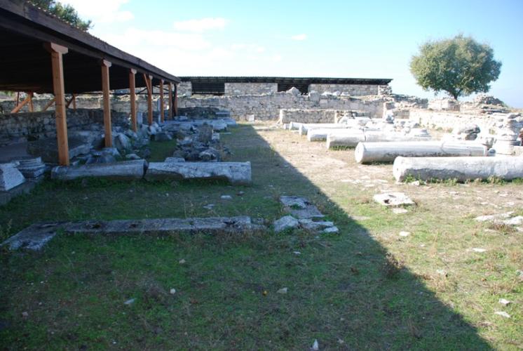 Amphipolis is located at the foot of Mount Pangaion, near the banks of the River Strymon. Archaeological evidence indicates strong human presence and activity in the area from as early as the Middle Neolithic. Built like an amphitheatre at a strategic location, Amphipolis was an Athenian colony founded in 437/6 on the site of Ennea Hodoi (Nine Ways), and the earlier city of Hedonia. Public and private life in the city blossomed during the Classical and Hellenistic periods, while the fact that the Via Egnatia passed through Amphipolis was a key factor in maintaining its prosperity through Roman and early Christian times. At least until 692 it was the seat of a bishop, and grew into a major centre of ecclesiastical activity in the area. Excavations within the city limits have revealed four basilicas decorated with sumptuous mosaics and marble revetments, an episcopical palace and a centrally planned church, all dating to this period. At this time the city was fortified by a 7.5 km long wall, and a second enclosure 2.2 km in length, bounding the citadel. More
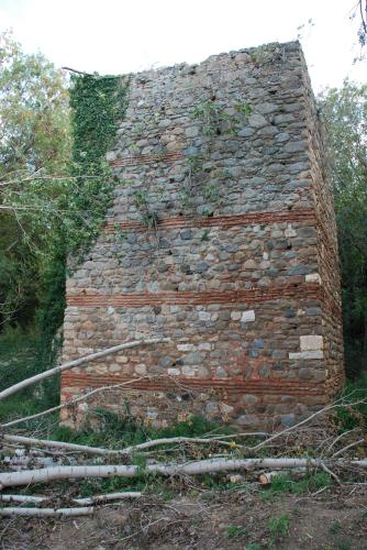
Rendina
 The naturally fortified mound of Rentina is located approximately 75km northeast of Thessalonica, south of the Richios River and next to the ancient Via Egnatia. Excavations carried out on the hill and its environs have revealed traces of human presence since Neolithic times; on the basis of their construction and associated finds, the building walls and abutments unearthed in the southwest section of the castle date to the Hellenistic period. Rentina lies close to the settlement of Arethousa, which went into decline from the 6th century onwards. According to one interpretation, Rentina may take its name from the nearby staging post (mutatio) called Peridipidis (genitive: Peripidinis). More
Thessaloniki
 Around the top of the Thermaic Gulf there were several small ancient towns with intense commercial activity, which further expanded after the destruction of Olynthus by Philip in 348 BC. According to Strabo, King Cassander founded a new city in 316 BC, naming it Thessaloniki after his wife, sister to Alexander the Great. The few traces of Hellenistic buildings identified to date - an important administrative building complex in Governing House Square, and the east part of the wall - indicate that from the outset the city was intended to be a major political and military centre. Thessaloniki’s geographic location at a key point on Macedonia’s land and sea routes was an important factor in its growth down the centuries. More
Gynaikokastro
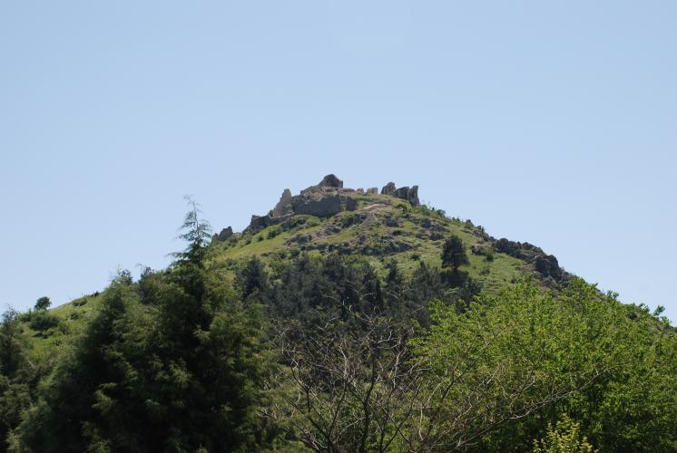 Gynaikokastro is located at the top of a steep hill in the centre of the Axios River valley, about 59 km north-northwest of Thessaloniki. The castle was built between 1328 and 1341 by the Byzantine Emperor Andronicus III Palaeologus, as part of the fortification programme implemented immediately after his accession to the throne, to strengthen the defences of the Macedonian capital, Thessaloniki, and its environs, and to control the crossings towards western Macedonia. Legend has it that the fort was so strong it could be defended by a female guard, thus giving rise to the name Gynaikokastro (literally = “Woman’s castle”). The castle was the repeated focus of armed conflict: seized by Stephen Dušan after the civil war following on from the death of its founder in 1341, it was then returned to the Byzantines by agreement, but captured by the Ottomans in 1373/74. In the 15th century Gynaikokastro was granted to an Islamized Byzantine pronoiarios , before finally being abandoned and falling into ruin in the 17th century. In the early 20th century, systematic removal of building material from the north and west sides to build houses in the adjacent refugee settlement led to extensive damage to the castle walls. More
Veroia
 Veroia is located at the east foot of Mount Vermion, at an altitude of 130 meters. It shows signs of continuous habitation from antiquity. The city flourished in Hellenistic times, especially under the Antigonid dynasty, successors of Alexander the Great who hailed from Veroia, and also in the Roman period, when it became seat of the Macedonian Koinon (Confederation). Christianity was preached relatively early on, and there is formal evidence of a Bishop being present from as early as 325. In early Christian times Veroia grew into an important administrative, military and religious centre. Considerable change to urban planning was wrought by the addition of imposing religious and secular buildings, which transformed the face of the city. More
Servia
 The present-day city of Servia is located in the Aliakmon River valley, on a rocky mound surrounded by deep ravines. The medieval walled town of the same name was located on the hill above modern Servia and, according to Constantine Porphyrogenitus, took its name from the Serbs who settled there in the 7th century with the permission of Emperor Heraclius. More
Kastoria
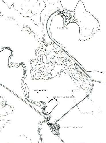 Located in Western Macedonia, the city of Kastoria is the capital of the prefecture of the same name. It lies between the Verno (Vitsis) and Grammos Mountains, on a narrow peninsula which widens as it projects into Lake Orestiada, also known as Lake Kastoria. Its geographical location and naturally fortified position, described by Anna Comnena when her father Alexius I Comnenus besieged the city, rendered it one of the major hubs in Western Macedonia. This was a decisive factor in the city’s economic and cultural development. More
Aggelokastro
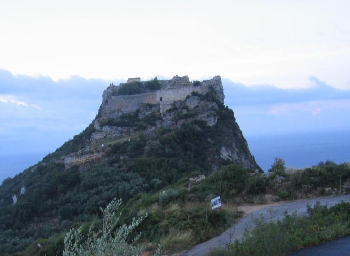 Aggelokastro, one of the main fortress complexs of Corfu, occupies a strategic position on the north end of the island controlling the south Adriatic Sea. Archaeological evidence suggest the hill was originally used in the 5th-6th century, while the site’s fortifications were possibly carried out by the Komninos dynasty, thought this is not substantiated be written sources, in their struggle to defend Corfu against the repeated raids of the Normans of Sicily. Aggelokastro was seized in 1272 by the Angevins knights of Naples, as shown by the report of receipt of the Fortress, which is the earliest mention of Agelokastro. More
