

The city
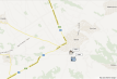
The present-day city of Servia is
located in the Aliakmon River valley, on a rocky mound surrounded by deep
ravines. The medieval walled town of the same name was located on the hill
above modern Servia and, according to Constantine Porphyrogenitus, took its
name from the Serbs who settled there in the 7th century with the permission of
Emperor Heraclius.
Because of its strategic importance and location right at the crossroads
between Western Macedonia and Thessaly, Servia was inhabited from antiquity,
and had strong fortifications that protected the city against various hostile
raids down the centuries.
Ruins of secular buildings have been unearthed within the castle walls,
especially in the citadel area,
as have sections of the Byzantine city cemetery on a hill to the east.
Important Byzantine and post-Byzantine ecclesiastical monuments still survive inside
the fortified walls in the lower city, the most important being the Episcopal Basilica
and the single-nave churches of Agios Theodoros (second half of the 11th
century.), St. John the Baptist (late 14th century), and the Holy Apostles.
Similarly, several small post-Byzantine churches and chapels survive
outside the city walls.
Glossary (1)
basilica:
type of large church, divided internally into three or more naves. The central nave was usually covered by a raised roof with windows that illuminated the space.
Information Texts (0)
Bibliography (4)
1. Ευγενίδου Δ., Κάστρα Μακεδονίας και Θράκης, Βυζαντινή Καστροκτισία, Athens, 1997
2. Καραγιάννη Φ., Οι Βυζαντινοί οικισμοί στη Μακεδονία μέσα από τα αρχαιολογικά δεδομένα (4ος – 15ος αιώνας), Thessaloniki, 2010
3. Πέτκος Α. Σ, Σέρβια. Μια βυζαντινή πόλη-κάστρο. Διαδρομές στο χώρο και στο χρόνο.
4. Τσιλιπάκου Α, Σέρβια. Μια βυζαντινή καστροπολιτεία, Υπουργείο Πολιτισμού, Ταμείο Αρχαιολογικών Πόρων και Απαλλοτριώσεων, Athens, 2002
Comments (0)